
Soooo….since my new favorite hobby in lieu of proper fieldwork has been meandering round local historical sites (see previous post re: The Archaeology of Silicon Valley), I decided to up the ante a little bit and take my surveying and my penchant for investigating everyone’s digital systems to the next level: the proper National Parks.
And since I happened to be headed out on a rather fantastic road trip across the Wild West–I used the opp to meander into as many parks as I could and politely interrogate and observe their use of digital data and technologies on site and where possible, in their planning purposes.
Voila:
Research Questions:
How are the National Parks utilizing government collected digital sensor data on site? Or aren’t they?
How would they like to use digital media and new technologies (VR, AR, MR, etc) as an engagement and research tool?
How aware are the park staff of digital data collection and its visualization possibilities?
Methodology:
Query on-site rangers regarding digital data:
- collection
- storage
- use
- availability
- engagement strategies
Looking onsite for:
- promotion of digital media
- engagement with visitors via digital data
- analog media created via digital data
Notes:
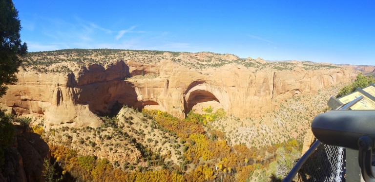
Navajo National Monument (NNM)
(= series of Anasazi/Pueblo Culture cliff dwellings in eastern Arizona)
Ranger #1(local lead, male):
Aware of recent digitization of site–initially indicated that the resulting 3D data would be used for an eventual display, but unsure if that would be in digital or in replicated digital (3D printing) form.
3D data of the monument not up anywhere—locked down on office drive, possibly hasn’t even been processed into model (he didn’t actually seem that sure about where the initial data was). No sharing policy on the current data (despite government funding to collect it). NNM planning on not even giving a copy to the National Park Service (NPS) or their partners, only groups cleared directly by the NNM itself will have eventual access.
Absolutely adamant that the data will be securely controlled. Had major worries over use of digital copy as a guide for looters, vandals, and unwanted hikers. Indicated that they don’t have the security or resources to handle an influx of either the good or bad visitors digitization was bound to attract. Already have part of the site (the two most distant cliff dwelling sites) closed off do to lack of infrastructure and fear of vandalism)
Following hike, returned to ranger station with follow-ups.
Ranger #2 (female):
Queried what team had done the digitization for them (interior NPS, CyArk, etc?)—she initially claimed the team was an organization called “LiDAR” —upon further discussion and the clarification that LiDAR was more likely the technology utilized for the digitization vs. the name of the team, she consulted Ranger #1–who also didn’t know who exactly had come with the equipment. Shifted dates on when digital survey was done from last year to the beginning of this year.
Raises larger concern regarding lack of digital data awareness among NPS staff on the ground, = intriguing future space for something to work with the NPS on digital awareness within its ranks vs just as a public outreach tool.
Also of note= the security concerns over access to the data by the public (see previous blueprint article “The Ban on Blueprints You Never Knew About” for further dialogue along those lines)
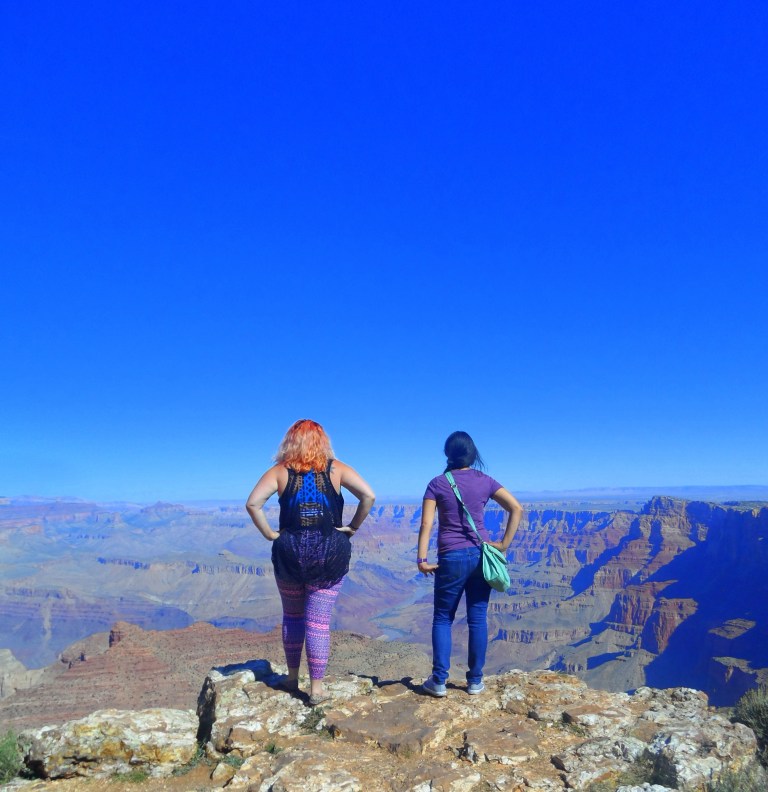
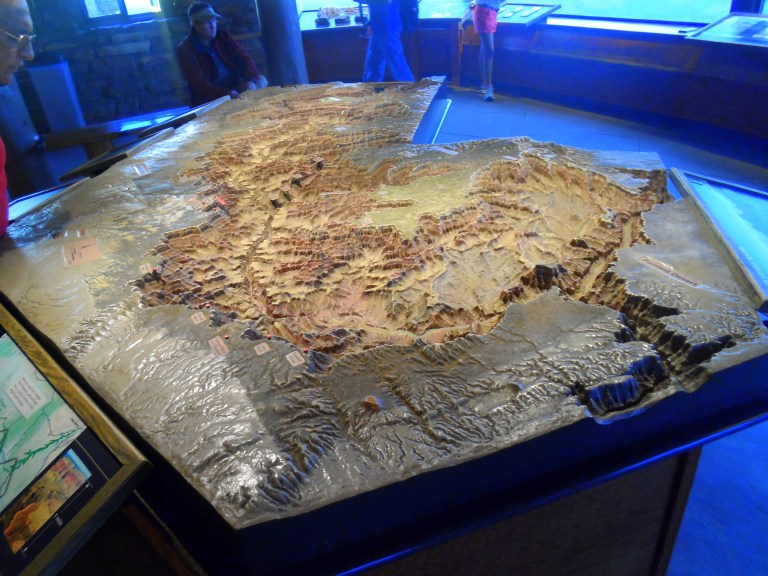
Grand Canyon National Park
Main Visitor Center & Geology Museum = guest ranger staff, but no proper rangers–no idea re: digital data use, again raises concern over lack of digital data awareness among the park staff.
BUT did have a DEM model posted as wall art in geology museum for reference (though staffer knew very little about it). Also had a physical large scale 3D terrain model of the park, but no postings or on-site awareness of how it was created (from DEM, from analog survey, etc) = common trend at all of the subsequent parks)


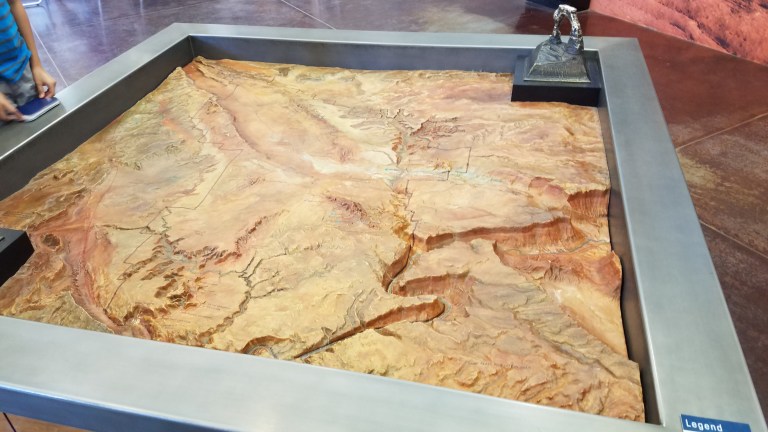
Arches National Park
Really awesome ranger at their main station. Super knowledgeable about everything but their digital data use–but once queried was keen to augment his knowledge on the digital data angle and figure out how to best use it in the park. Collected card to hand off to the regional digitization lead to connect us. Was particularly keen on queries regarding their physical large scale 3D model of the site terrain and whether or not it was initially created via data from a digital survey, wanted to fix their labeling system to reflect its origins, once its origin was discovered. Had concerns over outdated data use, really wanted mechanism for the NPS to have most recent data flowing in from other agencies—temporal/live stream style.
Zion National Park, Mesa Verde—passed through after closing–no chance to chat with anyone. Zion had another of the physical terrain model out front, collected SfM data from it to test.
Conclusions:
Like basically every government agency group I’ve had a chance to scope out–the National Park Service would distinctly benefit from digital data awareness and engagement systems, but will need new systems and mechanisms to do that on several levels. Not only do on site spots need to stream in the corollary digital survey data from the corollary agencies (USGS, NFS, NOAA, NGA, etc) and jut it back to the NPS in palatable formats) with levels of security control for internal planning and training and external engagement)—earlier steps need to be taken to even introduce the concepts of all of that lovely data to the park groups–who overwhelmingly seemed blissfully unaware that such data existed or how wonderfully it could be used.
And while I don’t want to super carp on the National Park System—because they really are trying to do some major good, and it’s not looking good for them under the upcoming regime of horror :(

Great article