
Following quickly on the heels of the Cyprus project, I was deployed as a staff member on the University of California, San Diego’s Edom Lowlands Regional Archaeology Project (ELRAP) Middle Eastern Archaeological Field School. Prior to my attendance at UCSD, I had volunteered with the ELRAP field school in the Fall of 2009 (during my MA work with the University of Leicester) and had then worked my way up to become Mistress of the Dirty Lab, responsible for cleaning and archiving incoming finds from the field. I had also helped them with the initial laser scanning initiatives of ELRAP’s main site Khirbat en Nahas and the survey excavation of Khirbat al-Ghwayba.
In Fall of 2011, I was responsible for both laser scanning the sites of interest and training up some of the fabulous undergraduates who were attending the field school (best field assistants and future friends ever!).
Armed with a Leica Scanstation 2, Leica’s Cyclone software for point cloud processing, and Vid’s software for visualization (and Vid on call from Italy & San Diego for digital troubleshooting) – I scanned a bevy of sites in southern Jordan’s Shobak and Wadi Faynan regions, including:
*Khirbat al-Iraq- Dr. Neil Smith’s on-going excavation in the region.
*Three survey areas up on top of Jebel Safaha for the fabulous Kyle Knabb, fellow M*A*S*H enthusiast and provider of sanity during the hectic mountain climbs up Jebel Safaha and lab ridiculousness of Shobak
*Khirbat Negeib Asemer – a Martian landscape of an Islamic era settlement currently being studied by Ian Jones, yearly winner of the most adorable teddy bear archaeologist on the planet award.
*Khirbat Hamra Ifdan, a plateau settlement of Bronze Age metallurgical wonder being worked on by the timeless Aaron Gidding.
*Tell Tifdan, a landlocked Neolithic island on the edges of the Arabah which had been excavated over the last several decades by Thomas E. Levy & co.
* Khirbat Faynan–a 20+ hectare site centered around a central tell peninsula which encompasses an intricate palimpsest of layered ruins representing a plethora of time periods. During the late Roman period, Khirbat Faynan was the big bad penal colony of the Roman Empire- home to a complex society of skilled metal workers and slaves sent from all over the Empire. The unity of the large Christian populations that eventually formed there led to a massacre and disbanding of religious units at the colony. The matrydom of the Christians during this insurgency led to the site’s focal point as a place of pilgrimage during subsequent centuries- resulting in the construction of several, presumably wealthy, monasteries and churches on the slopes of the ancient ruins. Long abandoned, the site has rarely been excavated, but oft excitingly surveyed. As it sadly lies outside the boundaries of the UNESCO Dana Nature Preserve and in a rival tribal territory to previous ELRAP field seasons- it presented a plethora of political challenges.
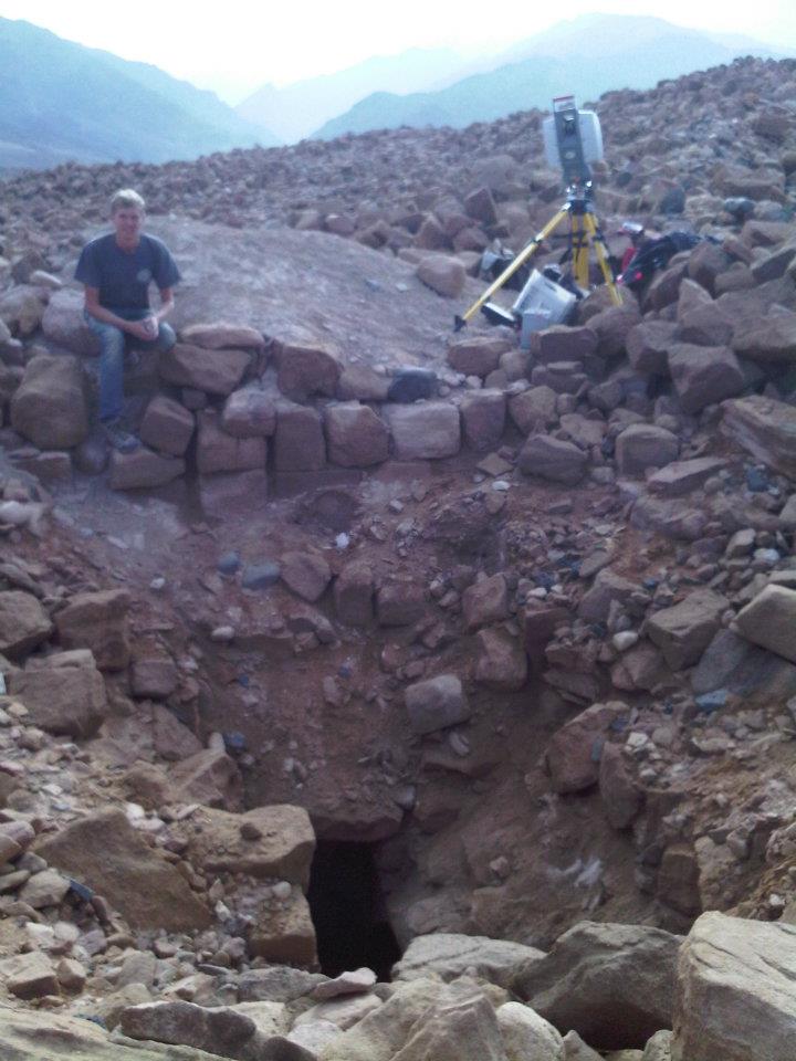
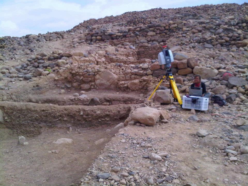
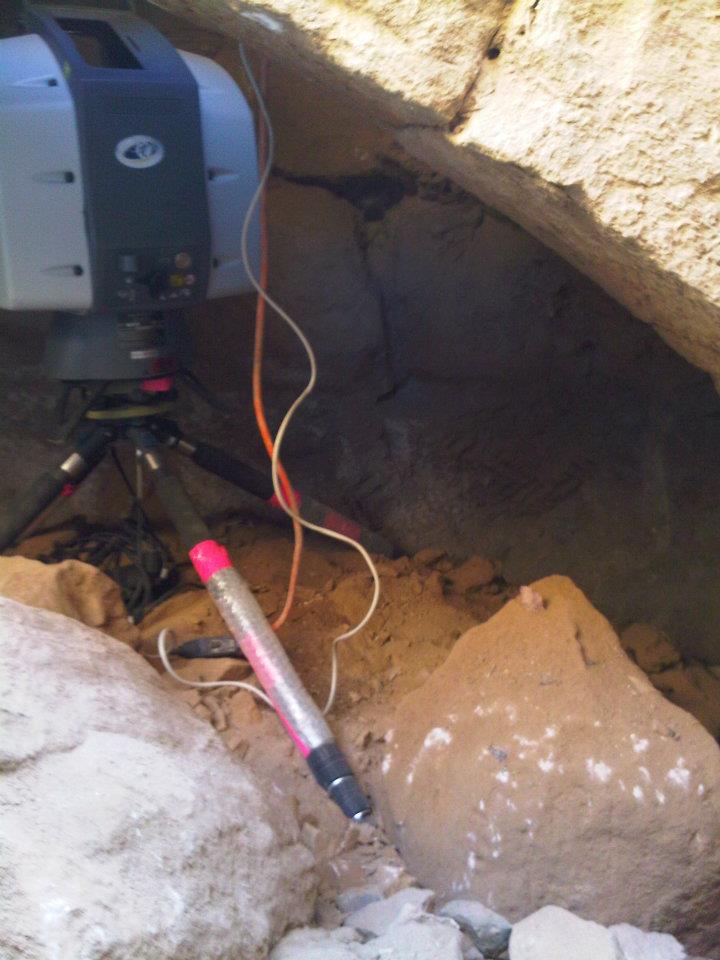
As the central focus of my laser scanning survey, the majority of my field experiments to speed up the scanning process were conducted here and then utilized at the other, smaller sites. This included the implementation of the infamous tilt head, which allowed the scanner to reach downward angles the traditional set-up misses (downward being particularly useful for efficiently capturing excavation pit data); and the accumulation of lots of sneaky tricks for the data collection and processing of large landscape traversals.The excavation area on the western slope also provided the first ELRAP case study for scanning an on-going excavation.
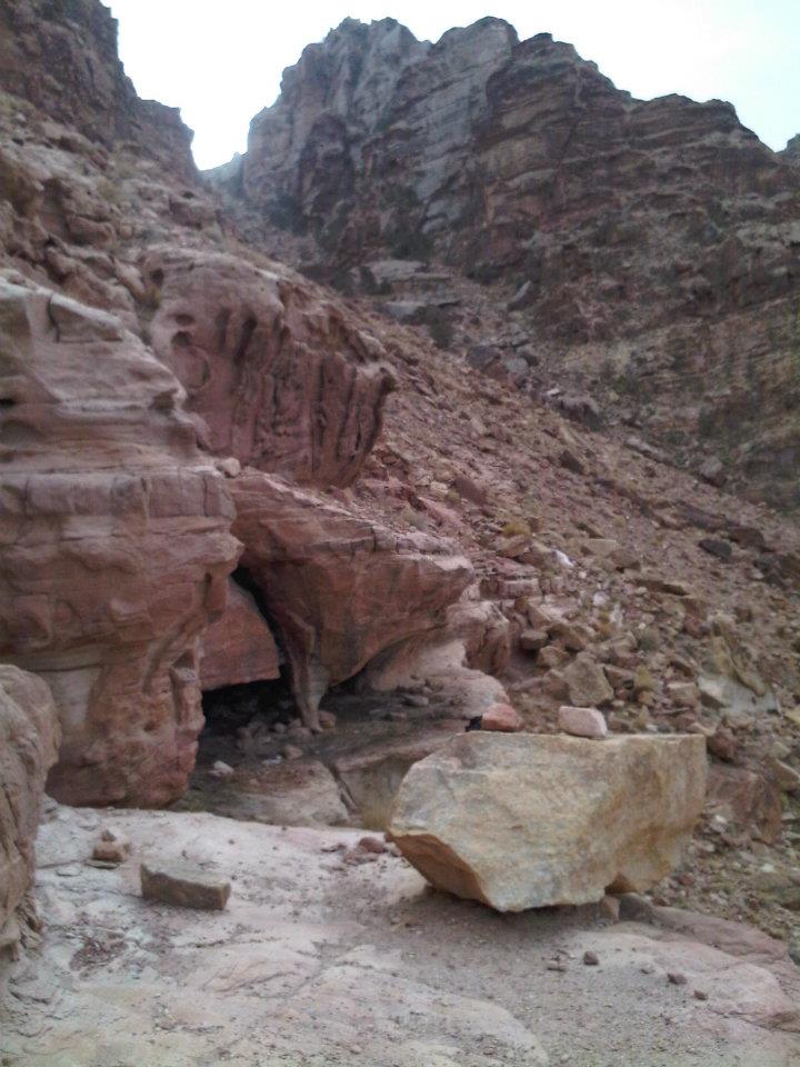
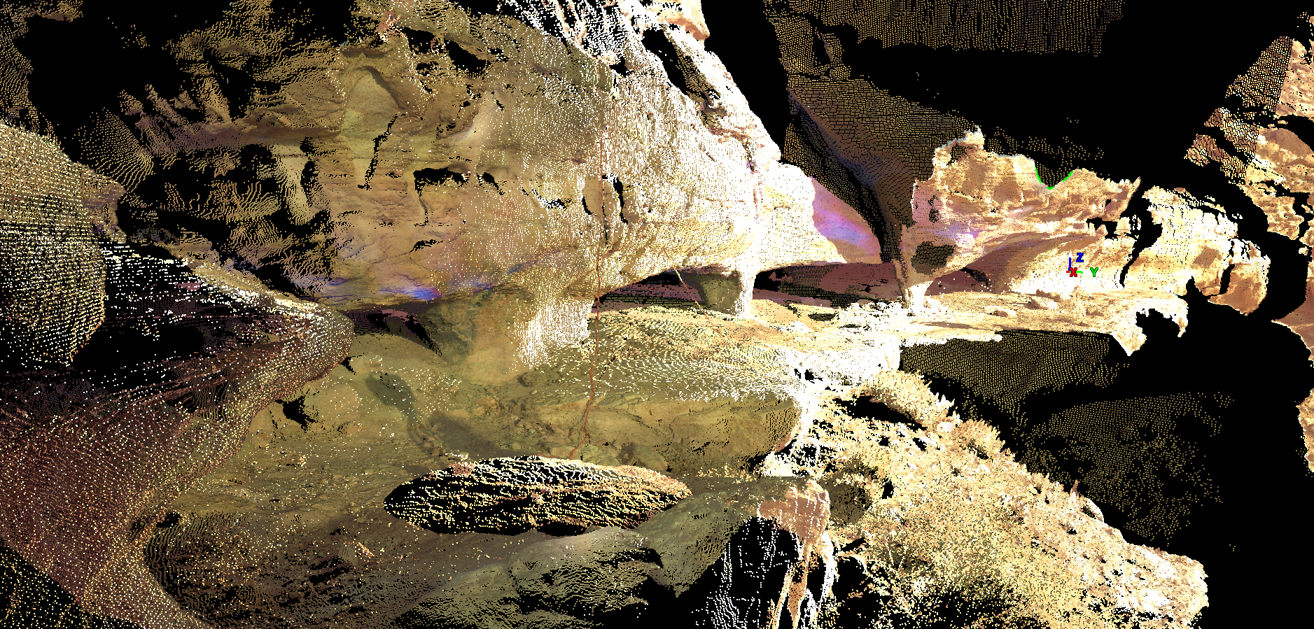
*Towards the end of the field season, with new methodologies and well trained assistance from future CyArk staff member and archaeology elite Ross Davison, we were given the extraordinary challenge of scanning the mining complex of Umm al-Amad. Its name, which translates to ‘the Mother of Pillars’ is derived from the monumental style buttresses which were carved to support the mining cave complex. Very little of the original cave system is believed to be natural, its current shape is courtesy of the hundreds of human hands which painstakingly carved it out of the bedrock, hunting out precious copper for their Roman overlords. Where Khirbat Faynan was one of the Roman Empire’s harshest penitentiary complexes, Umm al-Amad was likely the most dangerous and harshest punishment an already punished slave could be sentenced to.
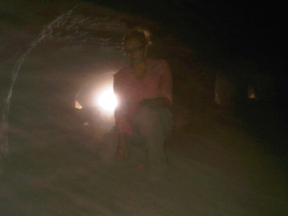
Tucked far away in the mountain peaks above the Wadi Faynan, Umm al-Amad was in the process of being indirectly destroyed by local mining interests dynamiting a nearby stretch of mountain to build a road. The local Bedouin informed ELRAP director Thomas E. Levy, who commissioned a last minute day long survey to collect what intangible data we could from a quick survey of the site. Filled with a thick, cushy layer of goat dung and with only the lights of our phones, Ross Davison and I braved the cave darkness and occasional tremors for 8+ hours to digitize a majority of the beautiful but tragic man-made site.
Check out the mini-video of the project on youtube.
Special shout outs belong to Khalifa, my Bedouin escort and strong-man extraordinaire. To the wonderful and well-humored Dr. Mohammed Najjar. And my cadre of dedicated undergraduates who helped me schlep a ridiculous amount of equipment all over the brutal but gorgeous desert landscape of the Wadi Faynan. Many thanks go especially to the tiny and indestructible Leah Trujillo, our resident Tin-Tin Ross Davison, the wonderful Egyptologist Paul Verhelst, the endlessly magickal James M. Darling, the magnificent Jessica Linback, the marvelous Annie Jessup-and many many more…
For more formal proceedings on my work this particular season- check out the resulting publication in IEEE Virtual Systems & Multimedia (or the subsequent blog about its presention in Milan in the fall of 2012) : “Terrestrial Laser Scanning (LiDAR) as a Means of Digital Documentation in Rescue Archaeology: Two Examples from the Faynan of Jordan.


xxx Ashley M. Richter xxx
